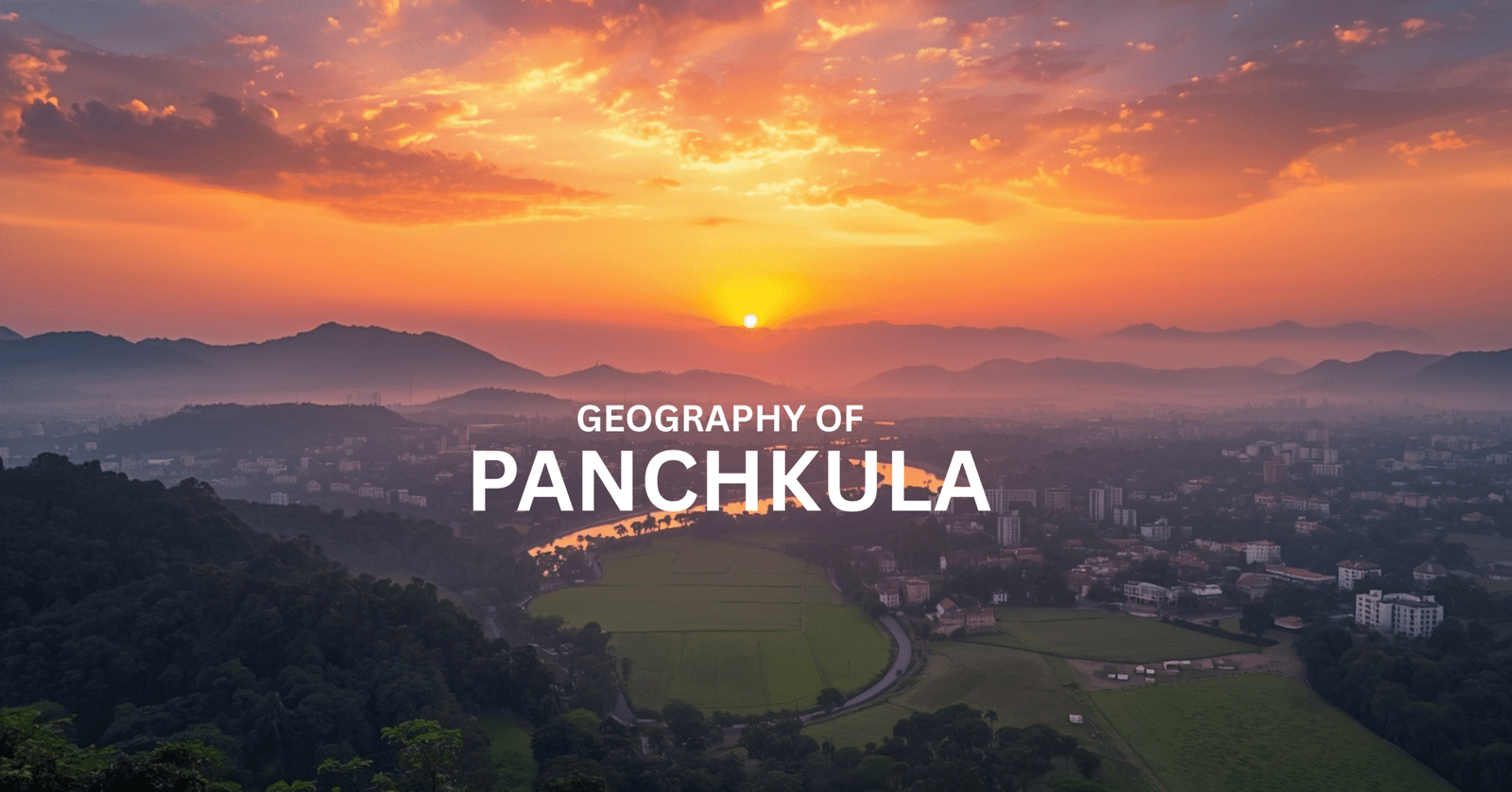
Hey there! If you’ve ever driven into Panchkula, you know that moment when the flat plains start bumping up into those Shivalik foothills—it’s magic. Panchkula geography is this perfect mash-up of rugged hills, winding rivers, and wide-open fields that makes the city feel alive. Tucked in Haryana right next to Chandigarh, it’s like nature’s welcome mat to the Himalayas. I’ve hiked these parts plenty, and let me tell you, it shapes everything from the food on your plate to where the best views are.
Where It All Sits: Foothills and River Edges
Picture this: Panchkula sprawls over 121 square km at about 30.7°N, 76.85°E, hugging the Shivalik Hills’ edge. To the south, Chandigarh buzzes; west, the Sutlej River flows steady; north, Himachal’s wilder side calls. The land climbs gently from 300m plains to over 1,000m peaks, dotted with seasonal streams called choes that rush down after rain.
My favorite? The Morni Hills, topping out at 1,167m—Haryana’s only real hill station with lakes and trails that make you forget you’re near a city. Then there’s the Ghaggar River snaking east (folks say it’s the old Saraswati), and Kaushalya River bubbling from the hills, feeding wetlands full of birds. This mix means killer sunsets from high sectors and super fertile soil below for farming.

Weather That Keeps You Guessing
Thanks to Panchkula geography, summers hit 45°C and feel brutal till the monsoons crash in with 800-1,000mm rain. I love winter though—crisp 2-5°C mornings with fog rolling off the hills like a blanket. The Shivaliks trap that Bay of Bengal moisture, so hills stay greener and cooler than the plains.
It’s why Panchkula grows amazing mangoes, kinnow oranges, and flowers. But lately, with climate weirdness, rains are patchy, and those Shivalik aquifers are straining. Still, grab a shawl for December picnics—pure bliss.
Rivers, Dirt, and Hidden Gems
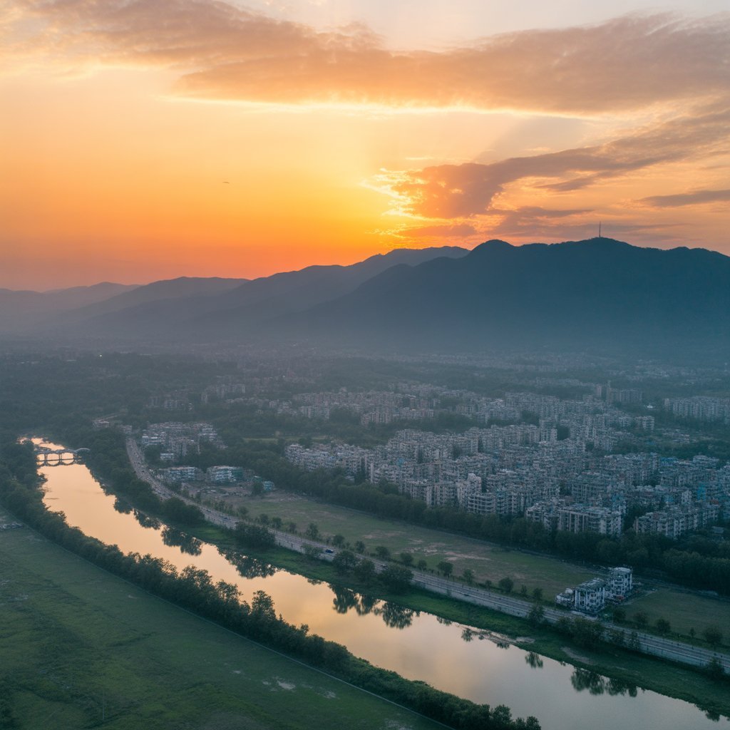
Rivers rule here. Sutlej and Ghaggar bookend the city, with Sirsa and Tangri branches filling reservoirs. The soil? Silty gold from Himalayan wash-downs, perfect for wheat, rice, and veggies. Forests—sal trees, acacia, khair—cover 15%, hiding leopards and birds in spots like Khol Hi-Raitan sanctuary.
Quarrying scarred some hills, but restoration’s kicking in. Quick look:
| Spot | What It Is | Why It Rocks |
|---|---|---|
| Shivalik Hills | Rocky ridges | Treks, wildlife, Morni magic |
| Alluvial Plains | Rich, loamy fields | Farms feeding the region |
| Choes Streams | Flashy hill runs | Recharge wells, adventure vibes |
| Ghaggar River | Ancient flow | History, birdwatching heaven |
City Life Meets Nature’s Rules
Back in the ’50s, planners like Albert Mayer used the land’s natural slopes for Panchkula’s neat sectors—drainage flows right, green belts everywhere. But growth means challenges: hillsides slipping from cut trees, sprawl eating wetlands, water running low (only 30 MCM groundwater yearly).
The 2031 plan pushes back with 25% green space and rain capture. Smart move—keeps that Panchkula geography vibe alive.
Why It Sticks With You
Panchkula geography isn’t just maps; it’s why this place feels balanced—hills for escape, plains for life. Head to Morni for a hike, Kaushalya Dam for chills, or Yadvinder Garden to unwind. In a hot, crowded world, it’s a reminder we can live with nature, not bulldoze it. Next time you’re nearby, pull over and breathe it in.
Climate: A Subtropical Transition Zone
Influenced by its Panchkula geography, the city enjoys a subtropical steppe climate (Köppen: BSh), bridging the arid west and humid east. Summers scorch up to 45∘C45∘C (April-June), while winters dip to 2−5∘C2−5∘C (December-February), often with fog blanketing the plains.
Monsoons (July-September) bring 800-1,000 mm of rain, fed by moisture-laden winds from the Bay of Bengal funneled through the Shivalik gaps. The hills trap this rainfall, creating microclimates: cooler, wetter uplands versus drier lowlands. This pattern supports horticulture—think mangoes, kinnows, and flowers—making Panchkula Haryana’s “fruit bowl.”
Climate change is altering Panchkula geography, with erratic rains and rising temperatures threatening groundwater in the porous Shivalik aquifers.
Rivers, Soils, and Natural Resources
Water defines Panchkula geography. The Sutlej and Ghaggar rivers form natural boundaries, while the Sirsa and Tangri tributaries feed local reservoirs like the Bhakra Nangal system. These alluvial soils—rich in silt from Himalayan erosion—are ideal for crops like wheat, rice, and vegetables.
Forests cover about 15% of the area, dominated by sal, khair, and acacia in the Shivaliks, hosting leopards, deer, and over 200 bird species in sanctuaries like Khol Hi-Raitan Wildlife Sanctuary. Quarrying for sandstone and boulders has scarred some hills, prompting eco-restoration efforts.
| Feature | Description | Significance |
|---|---|---|
| Shivalik Hills | Quartzite and sandstone ridges | Biodiversity, tourism (Morni Lakes) |
| Alluvial Plains | Loamy soils from river deposits | Agriculture, urban expansion |
| Choes (Torrents) | Seasonal hill streams | Flood risk, groundwater recharge |
| Ghaggar River | Ancient Saraswati remnant | Historical, ecological corridor |
Urban Planning and Environmental Challenges
Panchkula’s geography inspired its gridiron layout, with sectors 1-20 fanning out from the plains toward the hills. The 1950s master plan by Swiss architect Albert Mayer leveraged natural contours for drainage and green belts.
Yet challenges persist: deforestation for development erodes hillsides, urban sprawl encroaches on wetlands, and water scarcity looms as demand outpaces the 30 MCM annual groundwater yield. Initiatives like the Panchkula Master Plan 2031 aim to preserve 25% green cover and promote rainwater harvesting.
Why Panchkula Geography Matters Today
In an era of climate shifts, Panchkula geography offers lessons in sustainable living—balancing hill conservation with plain productivity. Trek Morni Hills, picnic by Kaushalya Dam, or stroll Yadvinder Garden to experience it firsthand. This geography not only roots Panchkula’s identity but fuels its growth as a vibrant satellite to Chandigarh.
Discover more about northern India’s hidden gems, and let Panchkula geography inspire your next adventure.